Page 2 of 2
Estes Park, Colorado
Headlights crest the hill, shadows pass her by and out of sight
If Denver is a mile above sea level (and it is), then Rocky Mountain National Park is two miles, with most of the park at or around 9,000 fasl and parts of Trail Ridge Road at 12,000 fasl. While I did not suffer any ill effects in Denver or Colorado Springs, I did in my quick, acclamation free trip to Estes Park. My first night there I had an acute headache on the upper left side of my head, one that seemed to return with some vengeance each time I went to an even higher elevation.
Such minor inconveniences as acute pain did not keep me from exploring, at least a little. The rest of these slides were all taken from my one big (enough) hike, the one that justified carrying my trusted Lowa boots on my back (in my luggage) on the LIRR all the way to the Jet Blue Terminal and all across Colorado
The relatively short trails I took went up and around Glacier Gorge- past Alberta Falls and to Mills Lake and the Loch. At just about seven miles and 1500 vertical feet, it was a small (enough) hike through such vast lands. This is at the (almost) halfway point at Mills Lake, a beautiful spot/wind tunnel deep in the day trip backcountry.
I had been to Alberta Falls in 1995 during a previous visit to Estes Park (in the Colorado mountains a "park" is a high mountain meadow- think South Park). The falls is just where I left it, less than a mile from the trailhead on the popular, wide and well maintained section of the trail.
After Alberta Falls the trail (in late May) began to get a bit more interesting. The trail was broken up into two basic sections. One section was a cold, thoroughly unpleasant wind tunnel with clear trail conditions, the other was still and warmer but had a thick layer of ice or snow where the trail should be. At times the snow was not as much fun as you think it would be. Sure my trusted Lowa boots were helpful, but nothing really helped on the steep downhill sections, especially of concern on areas with steep, icy, unforgiving dropoffs and no Verizon cell phone coverage.
This is a relatively flat section of the icy trail, just before the Loch. A consistently scenic and highly recommended trail, especially in the warmer months of June, July or August.
The centerpiece of Rocky Mountain National Park is Trail Ridge Road, an engineering marvel that crosses the Continental Divide and an actual arctic tundra, all the while avoiding such sea level inconveniences as guardrails.
I was in Colorado during the last week of May and during the first days that Trail Ridge Road was open for the season. The snowfall (at certain points of the road) is legendary, while other points remain too windswept to accommodate any accumulations at all. The Park Service takes great trouble to include a disclaimer about the road's status being only open as conditions permit, something which proved to be true the first time I had tried to ascend it- a late season storm (for us) had made the unguarded road conditions too dangerous to keep open. Luckily for me (and everyone else there that weekend) the road was reopened in time for the warmer (and sunnier) afternoon drive time.
This is from one of the many roadside turnouts in the high country. Normally a small trail leads you across the tundra to yet another overlook, in late May the trail felt generous and as wide as that late season snow would allow.
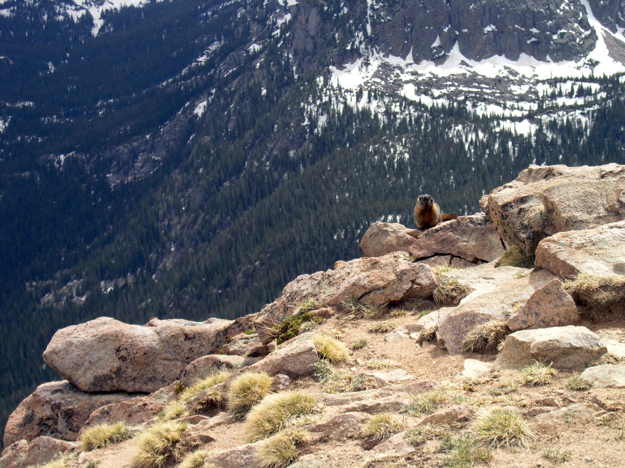
I claim not to be scared or intimidated by heights, still there were sections of Trail Ridge Road that make you think. The dropoffs (for the most part) are severe enough for you to realize that with one wrong turn you could expect never to be heard from again.
The very high poles located throughout the high country are there to help the people with the snow removal equipment to find the road, something that is probably fairly helpful considering the depth of what they have to move.
One of the most frequent complaints I hear regarding the slideshows (right after "they're too damn long" and "enough of that architecture-boy crap") is that (up to now) I haven't been featuring enough large scale snow removal equipment.
A sign at the (still closed and partially buried) Alpine Visitor Center alerts visitors to an Avalanche Warning. Sure, things might not be a problem at the top of Trail Ridge if an avalanche started, but one small push and all those trees, elk and bighorn sheep in the valley below would most certainly be screwed.

