Page 5 of 5
Mount Rainier National Park, Washington
Standing on mudflats watching the salmon fly
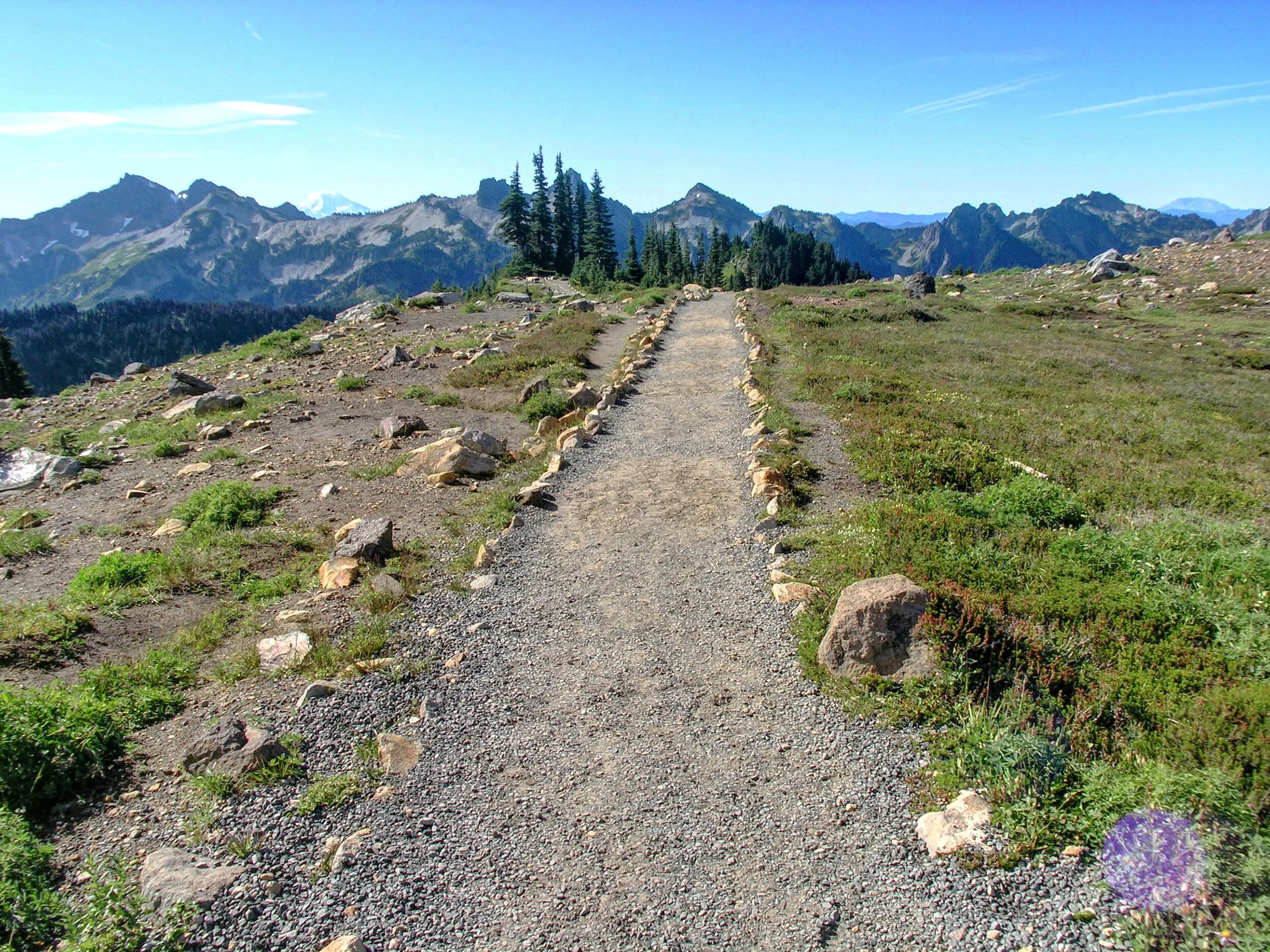
The main attraction of my all too short visit to Paradise was the Skyline Trail, an all too short six mile loop trail that climbs up the mountain past Panorama Point and somewhere above 7,000 fasl. The total altitude gain is over 1,700 feet, higher than the highest peak at Acadia in Maine (1,500 feet) but nothing terribly high out west. What those 1,700 feet and six miles will get you is a chance to get closer to the mountain, to see farther than you ever expected and to walk through subalpine (and later alpine) fields of whatever wildflowers are somehow still alive that late in August.
Closer to Panorama Point but not quite there, this is right about the point where my cell phone started working again. Visible over the Tatoosh Range (the closer volcanic mountains that are part of Mount Rainier) are Mount Adams, 40 miles away and 12,700 fasl (on the left) and Mount St Helens, 50 miles away and now only 8,300 fasl (on the right). Between the two and visible in person but not with my wide angle lens was Mount Hood, 90 miles away in Oregon at 11,200 fasl. It was in the center left, barely visible but definitely there at the one third mark between Adams and St Helens. Or maybe the altitude was screwing up my perception, in retrospect I guess we'll never really know.
And while the hike was short, the altitude made it feel much worse than expected. Another effect was the sun, something which I thought about but took no action against. Four (or five) days later in Chicago my sunburned forehead still hurt, despite the fact that it was peeling in such interesting, attention getting patterns.
There is more than one peak or trail at the park, but there's still only one star. The hike up Mount Rainier itself takes two days and regularly kills people each year. Well outfitted hikers depart from Paradise and head up to Camp Muir, straight ahead and across a few annoying icefields up to about 10,000 fasl. There they set up camp and go to sleep, only to wake up at midnight and start final 4,000 feet to the summit at Columbia Crest. The height of the mountain produces its own weather, most of it bad and unexpected, and it is calmer and more predictable in the early morning hours. After seeing sunrise, Seattle and the sound from the top (on a clear day), hikers descend all the way to the Paradise Inn where they sit on the porch, disassemble all of their expensive equipment arrogantly blocking all of the public spaces and loudly share stories about how great they are to have survived such a trip.
I was not completely alone on my journey. The furry little guy on the left is a marmot, a traditional subalpine resident in national parks all across the west. Marmots like to eat the wildflowers, whistle loudly when they see hikers, and, well, that's probably about it.
It’s back to Seattle and back to the sound for one last picture where, at the very edge of the waterfront, the Olympic Range hides behind all those expected clouds, just beyond the bay, just beyond the sound.

